

|
|
| Travelling to Wee Jasper is a journey through one of the most diverse geological landscapes in Australia. The road passes through a range of volcanic and sedimentary rocks with a mix of broadacre and grazing rural properties amid natural bushland. | 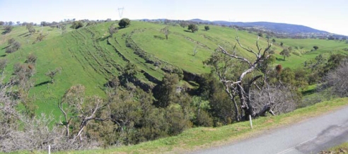 |
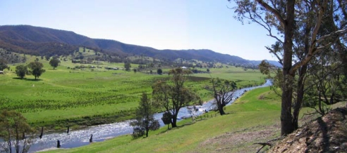 |
Winding down through fantastically folded belts of limestone you will enter a beautiful valley 20 km long with the Goodradigbee River running its length, surrounded by hills and containing a wealth of natural features. |
|
After crossing the
historic bridge over
the Goodradigbee River you drive through the village to the school at
the end of the road.
Turning North (right) the sealed road will take you 6 km out to Careys Cave. Turning South (left) you will pass the Memorial Hall and head upstream to the Wee Jasper Reserves on the river where you can camp overnight, bushwalk or just picnic and relax with nature. |
|||||||||
| LOCAL ACCOMMODATION:
|
|||||||||
| FOOD Unfortunately there is currently no food available in Wee Jasper. We suggest you pack a picnic and have it down by the river on one of the reserves. |
|||||||||
| FOR GENERAL INFORMATION ON YASS VALLEY AREA: www.yassvalley.com.au | |||||||||
| And if you are wondering what the weather will be like for camping ... CURRENT INFO |